

Projects
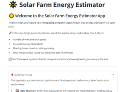
Solar Farm Energy Estimator
Solar Farm Energy Estimator is a professional tool designed to help engineers, designers, and decision-makers evaluate and optimize the layout and energy yield of a photovoltaic (PV) solar farm.
Using real-world parameters — including panel geometry, ground area, tilt angle, row spacing, and irradiance data retrieved from PVGIS — this app estimates:
• The optimal number of rows and panels that can be installed
• The expected annual energy production (kWh/year)
• Shading losses due to row-to-row shading
• Ground Coverage Ratio (GCR)
• System capacity based on actual panel specifications
Key Features:
• Adjustable row spacing with fine control (including decimal values)
• Support for custom mount structures and multi-panel tables
• Visualization of energy output vs row spacing
• Layout estimation based on land and panel dimensions
• Engineering summary based on internationally recognized models (Duffie & Beckman, PVGIS)
Target Users:
Solar designers, civil engineers, EPC contractors, energy consultants, and project developers.
Goal:
To empower users to quickly explore layout options, understand trade-offs between land usage and energy yield, and make data-driven design decisions before committing to physical construction.
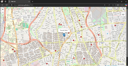
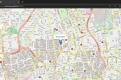
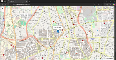
MapHive
MapHive is a comprehensive WebGIS platform where mapping and geographic data are collected, organized, and shared in one place. In this project, by leveraging the latest web technologies such as HTML, CSS, JavaScript, and Esri Leaflet, I developed an advanced PWA that enables users to easily explore, search, and interact with mapping data.
GNSS Satellites Multipath Detector
A MATLAB-based software that can detect and correct moments of multipath occurrence in smartphone receiver observations based on the CMCD index.
(This project was conducted as part of my master's thesis.)
Displacement and Subsidence Estimation in the Mosha Plain after the Tehran Earthquake Using Sentinel-1 Satellite Images and Interferometry
Analyzed satellite data and used advanced interferometry techniques to extract displacement vectors and map subsidence in the region.
Cross-series point determination and analyzing water level variations
Cross-series point determination and analyzing water level variations for ascending and descending satellite passes, identifying discrepancies between time series to assess satellite
numerical errors.
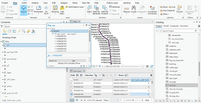
GAM MobileGIS
Advanced Spatial Data Management at Your Fingertips
GAM MobileGIS is a powerful web-based application designed to streamline the collection, management, and processing of spatial data. This advanced tool significantly enhances the speed, accuracy, and efficiency of surveying and geospatial information management projects.
Key Features of GAM MobileGIS:
-
Spatial Project Management: Create, store, and update multiple projects with customized data.
-
Advanced Layer Control: Add, remove, and edit map layers with precise and user-friendly settings.
-
Data Import and Export: Support for various formats to easily transfer spatial data.
-
Accurate Measurement Tools: Measure distances and areas directly on the map with intuitive tools.
-
Comprehensive Project Overview: Monitor the status and progress of projects in an organized manner.
-
Smart Assistant: Step-by-step guidance and support throughout the application.
-
Responsive Design: Optimized for mobile and tablet use without requiring any additional installations.
With GAM MobileGIS, managing spatial data has never been easier.

Creating a GIS Data Model for Managing the National Power Grid
This GIS data model has been designed for managing information related to the national power grid. The goal of this model is to optimize the transmission and distribution of electricity and facilitate the management and analysis of geographical data in the electricity sector.
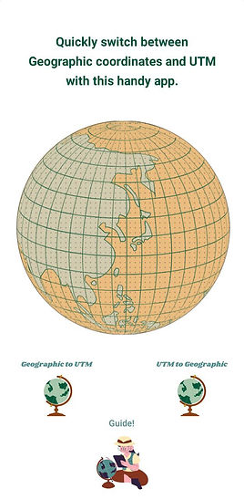
Datum Convertor
This application is a lightweight tool for converting Universal Transverse Mercator (UTM) coordinates to the World Geodetic System 1984 (WGS84) and vice versa.
Calculation of GPS Station Displacements in the National Geodynamics Network and Strain Ellipse Analysis using Finite Element Methods
Analyzed GPS time-series data from 2006 to 2018, calculated station displacements, and used finite element methods and triangulation between stations to compute strain and shear values. This demonstrated her technical ability and the application of advanced methods to solve real-world problems.
Determining real-time water level variations by applying geophysical corrections
Determining real-time water level variations by applying geophysical corrections over a period of at least ten years and deriving linear trends from the water level time series.